Showing posts with label Maps. Show all posts

Saturday, May 14, 2011

Origin of the Newmark Surname

When you're dealing with unfamiliar geography, especially historical geography, maps can be quite useful.

I found this map of 1320 Brandenburg. (source) It is believed the territory called Neumark is the origin of our surname.  You can note that the Oder and Warthe rivers form one of the boundaries.


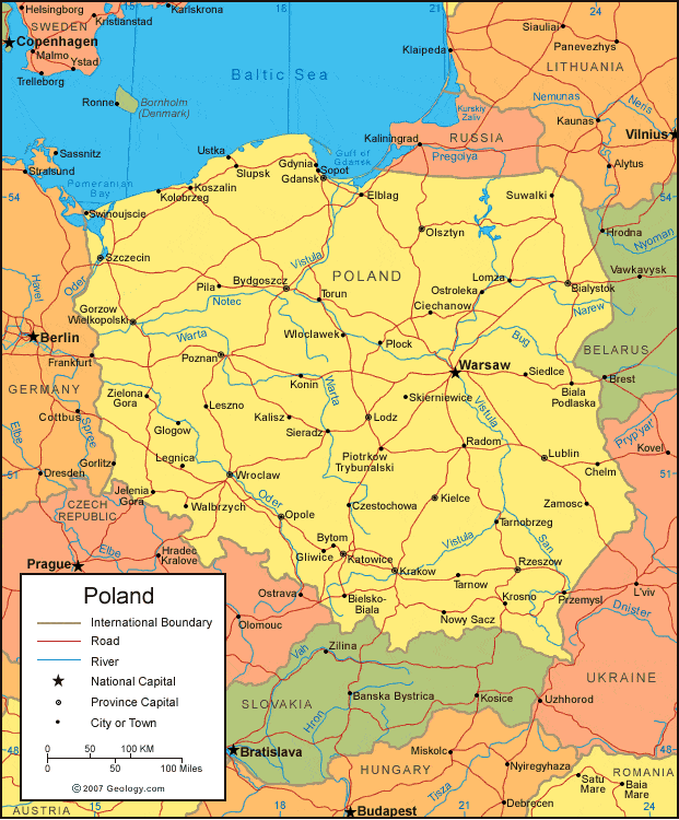
I am only able to trace my particular Newmark ancestors back to Warka, Poland, near Warsaw. How did they travel there? They could have traveled most of the way by following Poland's river system, with minimal land crossing near Bydgoszcz.  (The Oder and Warta rivers can be found in the upper left.)  We have no idea when they left Neumark, and entered Poland.  All we know is that they were in Warka by the 1880s.

(image source)

Friday, June 4, 2010

Follow Friday: Sanborn Maps

The Sanborn Fire Insurance Map Company, established in 1867, compiled and published maps of U.S. cities and towns for the fire insurance industry to assess the risk of insuring a particular property. The maps are large scale plans of a city or town drawn at a scale of 50 feet to an inch, offering detailed information on the use made of commercial and industrial buildings, their size, shape and construction material. Some residential areas are also mapped. The maps show location of water mains, fire alarms and fire hydrants. They are color-coded to identify the structure (adobe, frame, brick, stone, iron) of each building. [source]
Being able to look at the buildings and area that surrounded an ancestor's homes can be very helpful.  Below is an image from a St. Louis City 1909 Sanborn map showing the 1100 block of North 8th Street.  My great grandfather, Herman Feinstein, was a teenager at 1122 N. 8th from 1896-1906.  The 1909 map places a "Jewish School" immediately behind that address.  I hypothesized that he may have gone to school there.


Where can you find Sanborn Maps?  The Library of Congress has uploaded some of them [for AK, AL, AZ, DC, GA, LA, MA, MD, ME, MI, MO, NC, NE, NV, PA, TX, VA, and Mexico (Coahuila)].  And they have an index by state, county and year for their holdings in their Geography and Map Room, and they offer duplication services.

You may be able to access some through your local library.  Proquest has over 600,000 of the maps, covering 1867-1970, and makes them available to libraries.  (The St. Louis County Library, for example, has purchased access to the Missouri and Illinois maps, and any resident with a library card can access them from home.)

Wikipedia has a list of online archives.
Thursday, February 18, 2010

Google Maps of my Ancestors

Category 4 of the Winter 2010 Geneabloggers Games is "Expand Your Knowledge"

Task A is: Use Google Maps to map out an ancestral location. Create a map that you can then embed into a blog post.

Below is a map of St. Louis addresses for my maternal grandmother, Myrtle (Van Every) Deutsch. She moved to St. Louis in 1920, and except for a brief period in 1945 when she moved to West Palm Beach, FL, she was in St. Louis for the rest of her life. Before her marriage, she moved around a lot. [Click on the '-' button to 'Zoom out' and see all the addresses, or click on "View...in a larger map".]


View St. Louis Residences of Myrtle Van Every Deutsch in a larger map

This entry serves as my status update, as it is the only thing I've done today for the competition.

Wednesday, April 23, 2008

Do the Missouri Sanborn Maps tell me where my great-grandfather went to school?

Thanks to the Missouri State Genealogical Association blog I learned that the Missouri Sanborn Maps are online.
The Sanborn Fire Insurance Map Company, established in 1867, compiled and published maps of U.S. cities and towns for the fire insurance industry to assess the risk of insuring a particular property. The maps are large scale plans of a city or town drawn at a scale of 50 feet to an inch, offering detailed information on the use made of commercial and industrial buildings, their size, shape and construction material. Some residential areas are also mapped. The maps show location of water mains, fire alarms and fire hydrants. They are color-coded to identify the structure (adobe, frame, brick, stone, iron) of each building.
If one isn't sure about street name changes, or renumbering, the Sanborn maps can help you plot where an address is on a current map by pointing out cross streets and other landmarks that don't change with time, such as parks. You can also find out what else was in the neighborhood, such as businesses, schools, or houses of worship.

The Missouri Sanborn maps online for St. Louis city are mostly from 1909. All four of my paternal second-great grandfathers were in St. Louis in 1909 - Selig Feinstein, Moshe Leyb Cruvant, Morris Blatt, and Samuel Newmark. They all moved around a bit as well, and when I added in some work addresses I had, there were a lot of addresses I could look up.

From the city directories I knew that from 1896 to 1906 the Feinsteins were at 1122 North 8th. My great-grandfather, Herman Feinstein, was age 10-20 during those years.


I think I have a good idea where my great grandfather probably went to school. The map above is from 1909, so there is no guarantee that the school behind where my great grandfather grew up was there for the decade prior.

The cross street at the top of the map is Biddle, and the Cruvant family lived at 701 Biddle briefly during 1897. The Blatts lived in the 1000 block in 1896. So the three families weren't too far apart during those years.